Citizen scientists
IMPORTANT PARTNERS IN TRACKING WEATHER
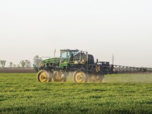
AGRICULTURE AND AGRI-FOOD Canada (AAFC) uses data from multiple sources to interpret and produce all kinds of agroclimate maps and information detailing things such as weather conditions and the impacts of climate on agriculture. Naturally, the more data that’s available, the clearer the picture becomes, so AAFC uses weather stations, satellites, and people on the ground to help collect this data.

AAFC says there are about 2,000 traditional weather stations located throughout Canada. And, while weather stations are great at capturing information about precipitation and temperature at a particular location, in some areas they are spread far enough apart that a weather event could easily pass between stations undetected.
This is where volunteer members of the public, also called citizen scientists, play an important role in collecting valuable data to fill in these gaps and help AAFC improve the quality of information it produces.
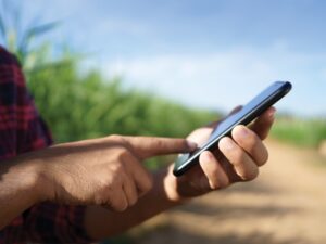
“Using volunteer citizen scientists is certainly not a new concept but it’s gaining a lot more traction because of social media,” says Trevor Hadwen, an AAFC agroclimate specialist. “Citizen science projects are a great way of allowing people who are interested in these subject matters to get involved with some of the science that’s occurring.”
IMPROVED ACCURACY
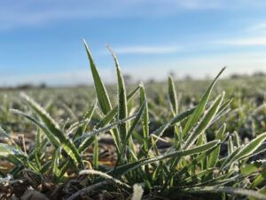
In fact, some tasks are actually better performed by humans than machines. An AAFC informational bulletin points to snow, as an example, which it says is particularly difficult to measure with automated weather and climate gauging stations because it can vary in density and doesn’t fall uniformly into measuring devices. In this case, volunteer reporters doing daily measurements improve both the cross-country coverage and the quality of the data being reported.
Hadwen cites two citizen science initiatives — the Community Collaborative Rain, Hail & Snow Network (CoCoRaHS) and the Agroclimate Impact Reporter — as projects which farmers may be interested in both participating in and referencing for information.
CoCoRaHS is a non-profit, grassroots, community-based network of volunteers of all ages and backgrounds who, using low-cost measurement tools, measure and map precipitation across Canada.
As Hadwen says, they’re AAFC’s citizen weather watchers.
“They basically have a rain gauge in their backyard, and they collect and measure precipitation for us on a daily basis, and then enter their values in a website,” explains Hadwen. “Through the website, you can see, in real-time, the amount of rainfall that has fallen in various locations around the country wherever there is a citizen recorder.”
Hadwen says CoCoRaHS is an excellent tool because it goes beyond Environment Canada’s data network, which he describes as “sparse” outside of major cities. As he explains, the precipitation data that is generally being reported by Environment Canada is captured at a major city airport, so unless you live right beside the airport, it may not necessarily reflect what has happened in your area.
“But, if you look on the CoCoRaHS network, you have a whole bunch of citizens — producers with stations on their farm, 4H clubs, schools, and all kinds of other different groups — collecting data all across the country for the CoCoRaHS network.”
USEFUL DATA
Another citizen-collected data initiative is the Agroclimate Impact Reporter. Started by AAFC in 2013, this easy-to-use online geospatial tool allows volunteers to report on the impacts of weather and climate conditions in their region. So, rather than providing purely numerical measurements, volunteer reporters qualify the impacts of weather conditions, which provide an important level of information for decision making.
For example, citizens might answer something like “To what degree do you anticipate livestock feed supply shortages over the winter — high, medium, low, or not at all?”
Reporters can also add specific details to help flesh out the interpretation.
“In some respects, it’s more important to know the impacts from conditions or events than to know the absolutes like how much it rained,” explains Hadwen. “There is no better source for impact information than those who live in the affected areas.”
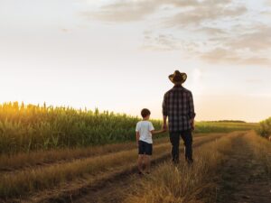
Hadwen is particularly interested in having more farm families and producers participate in these two citizen science projects. These boots-on-the-ground agriculture experts, he says, are important in helping AAFC not only collect data, but in truly understanding the impact the climate is having on the farm in terms of floods, insects, disease infestations, and related concerns.
Those interested in joining or learning more about the projects can contact Trevor Hadwen directly by email: trevor.hadwen@agr.gc.ca or by phone: 306-523-6796, or by visiting the project websites: CoCoRaHS www.cocorahs.org/ Canada.aspx and Agroclimate Impact Reporter www.agr.gc.ca/eng/programs-and-services/list-of-programs-and-services/drought-watch/agro climate-impact-reporter/?id=1463575416544.
USING SATELLITES TO MEASURE SOIL MOISTURE
Agriculture and Agri-Food Canada (AAFC) is participating in the development of the next generation of soil moisture monitoring, which uses satellites.
In January 2015, the U.S. National Aeronautics and Space Administration (NASA) launched the Soil Moisture Active Passive (SMAP) satellite. The satellite doesn’t measure soil moisture directly. Rather, it measures naturally emitted microwaves from the earth’s surface that reach the satellite in space, which are then converted to soil moisture levels using models. Through different experiments, including the recent “Soil Moisture Active Passive Validation Experiment 2016”, the models are being validated and tweaked to ensure the most accurate reporting.
Catherine Champagne is an agri-environmental scientist with AAFC and says this technology marks a huge step forward.
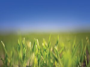
“Soil moisture isn’t routinely measured at weather stations, and where it is measured, it is difficult to use this information over a wider area because soil moisture changes a lot over a small area due to differences in the soil type,” explains Champagne. “So, soil moisture is usually estimated from rainfall measurements, which is indirect and not always accurate because we don’t always have very good information on how soils vary from place to place.”
Having an accurate snapshot of what the soil moisture is can tell program managers, agribusiness operators, and others a lot about how the weather is impacting farming operations and help the experts form more appropriate responses. •