Getting the lay of the land
MAKING THE BEST USE OF PRECISION AG TOOLS
most farmers would be hard pressed to find a piece of equipment rolling off the assembly lines without the latest and greatest tools for precision agriculture — but the challenge becomes figuring out what to do with it all.

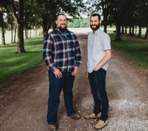
That is where physicist Dr. Mike Duncan and geographer Sarah Lepp of Niagara College come in. They are developing strategies with their team to help first-time precision agriculture users get started with a reliable way to address variability in fields.
“Precision agriculture is like business optimization for farmers,” says Duncan. The ultimate goal is to achieve what he calls “double green”. A concept of “achieving the best yields with the least environmental and financial impact.”
So, what tools are needed to start? Duncan and Lepp say a good GPS device and a yield monitor on a well-tuned, well-maintained harvester are key. With these, a yield map can be made for the field, along with a digital elevation model (showing the heights of land at all points in the field).
“These two models give us the starting point to begin listening to the field and work towards defining management zones,” says Lepp.
Duncan says the yield map shows where the field can support high, medium and low growth. “It’s like the term terroir in vineyards,” he says. “There’s always a small part of the land that produces the best grapes.”
Similarly, he believes within a field there are parts where 350 bushel per acre corn is possible, even likely – the challenge is knowing what to do with the rest of the field. “Make money where money can be made in the high yield areas, and save money in the low yield areas where it will be wasted,” he says.
field variability
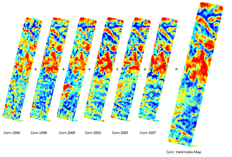
To start understanding field variability, Lepp says they first gather multiple years of yield maps together for a particular site and compare them year-to-year. “We look for stability,” she says, describing how they identify portions of a field where yields are consistently high, medium and low.
Then the research team looks for an underlying cause for a field’s yield stability. To do this, they turn a field’s digital elevation model into a 3D surface of the field that shows knolls, depressions, waterways and drainage patterns. By comparing this 3D surface against the consistencies in yield data, Lepp says they can relate a field’s topography to yield results.
What they’ve found in doing this is that high points in elevation, such as the tops of knolls, tend to have the lowest yields. Whereas, low points in elevation and slopes tend to have the highest yields.
Logically, Duncan says their findings make sense. “If a raindrop has the opportunity to roll downhill, it always will,” he says. “So a field’s topography will drive the dynamics of where water moves carrying with it organic matter and nutrients.” Naturally the knolls become worn away, while depressions become collection zones.
Knowing this, Duncan and Lepp say farmers armed with this information can begin to confidently manage various parts of a field to have predictable yields and reduced input costs by optimizing applications such as seed, fertilizer and spraying. Ultimately the team plans to develop “recipe maps” that will refine these techniques and include influences such as soil type and crop type.
Also involved in this research work are: Doug Aspinal, Donovan Bangs, Brendan Spearin and Stewart Sweeney of the Ontario Ministry of Agriculture and Food (OMAF). This work is supported by the Natural Sciences and Engineering Research Council of Canada, and partners IBM, AgInfoSys, Yellow-Gold Farms, Schuyler Farms and OMAF.
want to dig in?
The Niagara research team is looking for farmers interested in comparing their crop yields to field topography, and ultimately building recipe maps to address field variability. To participate, the ideal farmers will have at least five years of yield data for a location.
PHOTO: MULTI-YEAR INDEX.
For more information, contact Dr. Mike Duncan at mduncan@niagararesearch.org or 905-641-2252 ext. 4273. •