Water management
UNDERSTANDING GROUNDWATER
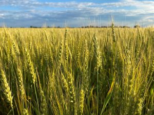
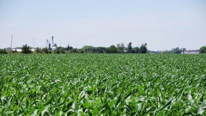
Water is a precious resource. The success of farm businesses and the health of our families depend on having a clean and abundant supply. Historically, agricultural technology has allowed us to manipulate the quantity and quality of water supplies to increase productivity. Today, this continues, with new technologies and a better understanding of natural processes. This article is the final in a series focusing on modern management of water for grain farms. Go to ontariograinfarmer.ca for more information and previous articles.

LANDOWNERS CAN DIG down and find groundwater under their land, it seems to be a matter of how far one has to dig. Groundwater for some farms is a matter of keeping the level down to allow for planting while others may want to find it and use it as a water supply.
Understanding the groundwater under the land may open up options for increasing yields using subsurface irrigation, controlled drainage, subsurface drip irrigation, or water supply choices in the event of a drought.
Knowing why part of the field is wet or mushy at times, whether it is just a local wet spot or deep groundwater coming to the surface from far away can help with drainage choices and reducing compaction. Knowing how and where groundwater moves over time allows for predicting where excess nutrients or surface spills will migrate. The quality of groundwater varies in the subsurface and is influenced not only by surface activities but by the materials it migrates through as it picks up and dissolves minerals. In general, the longer groundwater stays in the subsurface and the further it travels, the more minerals it will pick up.
This article provides an understanding of how groundwater works. Groundwater does not move the same in all locations, but varies with changes in Ontario’s soils, landforms, and bedrock. Ground water is a significant part of the water cycle.
Previous articles in this Water Management series explained the basic water cycle. This article will detail how subsurface variability impacts groundwater.
MOVEMENT
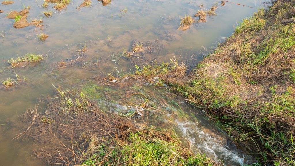
Groundwater will move from areas of high elevation to areas of low elevation. The high areas are called recharge areas where precipitation water moves down to the water table and flows toward lower elevation areas. In discharge areas, groundwater is moving up and discharging at land surface or water surface.
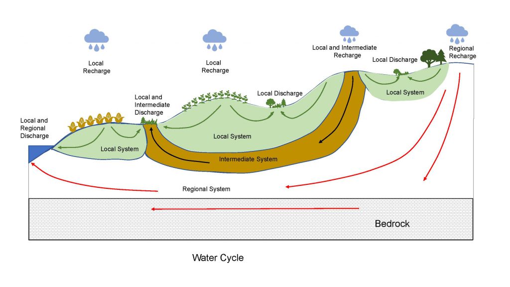
On a large scale, in excess of several kilometers, the groundwater may recharge in one area, flow down several 10s to 100s of metres in the soil and/or bedrock, move under small streams and rivers and discharge a significant distance away (Figure 1). The travel time for the water to discharge may be measured in thousands of years. In Figure 1, the regional system of groundwater flow is indicated by the red arrows. On a smaller scale, there may be groundwater flow which recharges in one area then flows under several fields before discharging at the surface, this intermediate system is indicated by the black arrows. Local flow systems usually occur in the immediate area and are indicated by the green arrows. The travel time here can be less than
one year.
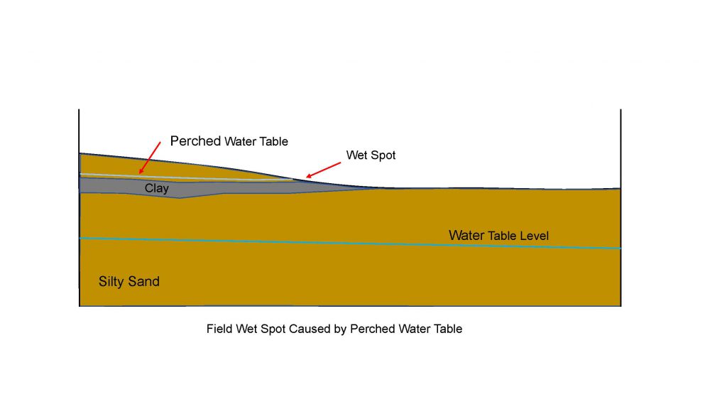
There may be cases where wet spots show up in a field but are not part of the flow systems just discussed. These wet spots may be caused by perched water tables. A perched water table is where water percolating down through the soil is slowed down by a tighter layer such as clay. The water pools on this layer like filling a bathtub until it overflows along the edges which may be the side of a field as shown in Figure 2. Perched water tables may dry out in the summer as groundwater is always flowing, sometimes very slowly.
The subsurface is not all one type of material and the soil at the surface may not be the
same all the way down to bedrock. Ontario soils were laid down by glaciers and moved around by water and wind after the glaciers melted. It is beyond the scope of this article to describe in detail the subsurface of all Ontario. While this may sound complex, the following methods can be used to understand the composition of the subsoil in your fields.
FIELD LEVEL
Farmers’ experience working, tending, and observing the land will help explain the subsurface. Areas in the field that dry out first, are mushy, soft, or retain water give hints about the subsurface. Areas of Ontario with large drainage ditches compared to others with no roadside ditches, or thick lush vegetation compared to sparse vegetation, help to explain the soil and water movement through it.
To explore further, start with where a field is located in the watershed. Source Water Protection Assessment Reports were completed for Southern Ontario several years ago and are available on line at https://www.ontario.ca/ page/source-protection or by contacting your local Conservation Authority.
The reports describe the soils and subsurface geology of each watershed and include figures of soil type, thickness, bedrock, groundwater flow directions, and recharge areas. In many cases, the reports describe how the soil and rock were deposited over time and why they change with location. The scale of the maps may mean fields will be the size of a pinpoint which can make it difficult to interpret.
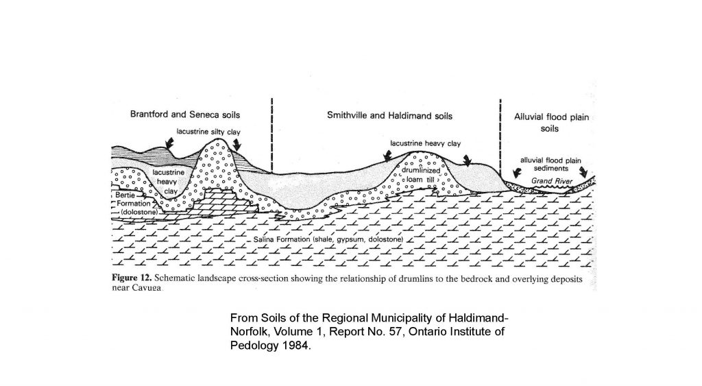
County Agricultural Soil Surveys provide detailed soil mapping of the upper one metre of soil and in some cases include cut away sections or cross-sections of typical subsurfaces in the area. The soil maps should confirm observations on the surface when working the field and the cross-sections will provide an idea of what conditions could be like in the subsurface (Figure 3).
The reports can be found at https://sis.agr.gc.ca/ cansis/publications/surveys/on/index.html and a sample cross-section is shown in Figure 3.
Some of the most detailed subsurface data in the province is provided by water well records. Water well records are required to be submitted to the Ministry of Environment, Conservation and Parks (MECP) for every water well constructed in the province. The well records describe the soil, rock, and water conditions from land surface to the bottom of the well. They also provide information on the depth to water, water found at (aquifer), quantity available, and quality. Most water well records will be located near a home or livestock barn. Water well records for your area can be viewed and accessed through the MECP website at https://www.ontario.ca/ environment-and-energy/map-well-records.
Construction activities on your farm or in the local area can yield valuable subsurface information. Consider asking local well drillers, excavation contractors, drainage tile installers, and old timers about their experience with the subsurface. Post hole augers or backhoes allow easy and quick observation of the subsurface. Keep records of the investigations that are done, even handwritten notes can be helpful to refer to in the future.
Getting a better understanding of how water is moving in the subsurface can help farmers better manage their crops and local water resources. It is important to understand that water moves under adjoining properties and protecting water resources is a shared responsibility of landowners, tenants, and the public at large.
FINAL THOUGHTS
This article is the final in our series on water management. We conclude with a discussion of groundwater because it is a shared resource and a shared responsibility. Groundwater is beyond our individual fields and farms. While we are dependent on groundwater to support our crops and other parts of our farms, others are reliant on the same resource. From a water management standpoint, we need to ensure the protection of groundwater in quantity and quality.
From this series it is important to understand that the way we collectively manage our crop production and soils can impact us and our neighbours, sometimes a great distance away. Cropping practices that enhance soil health prevent soil erosion by reducing overland flow of rainfall, promote infiltration which slows down water movement and provides filtration, recharges groundwater supplies and builds the water holding capacity of our soils.
Farmers are blessed today with high yield potential genetics. High yields require high inputs and more water to achieve their yield potential. Ensuring water and soils are well managed ensures our best opportunity to optimize crop potential. Optimizing production means achieving the highest profitability while minimizing the environmental risks associated with the production practices. The stewardship of water resources is a shared responsibility. •
Other articles in the series:
• Producing the best grain crop possible (September 2020)
• The water cycle and why should we care (October 2020)
• The role of farm drainage (November 2020)
• Improvements through soil health (December 2020)
• A second look at farm drainage (January 2021)
• Is irrigation of grain crops feasible (February 2021)
• Irrigation case study (March 2021)
• Understanding groundwater (April/May 2021)